In 1833 Peter Charles Varlé published the first comprehensive tour guide to Baltimore City.

It was a lovely volume filled with useful information and woodcuts of prominent buildings. As the engineer for the Susquehanna Canal he had spent time on the road away from the city, including a frightening stay in Philadelphia during the yellow fever epidemic of 1798, but for for the most part he had "lived among" the citizens of Baltimore for 30 years and wanted to pay tribute in print before retiring to his native Languedoc.
Baltimore had come a long way since Peter Charles Varlé arrived in Baltimore by way of Haiti from Southern France where he had first experienced the consequences of poor sanitation.
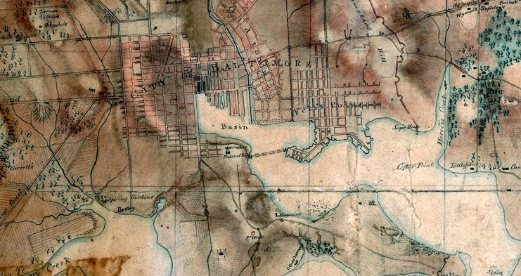
In 1814 the only detailed street and estate map of the City and its immediate environs available to the British and citizens alike was his carefully executed map, the rights to which he gave up to the Baltimore printers Warner and Hanna who issued the most popular version under their own names in 1801. Warner and Hanna still had the original copper plates (including one for a smaller edition published with a city directory) in the estate inventory of Andrew Hanna when it was ordered auctioned off in 1814 for the benefit of Hanna's son, but they have long since disappeared. Today Varlé's map can be superimposed on Google Earth with great accuracy with regard to the main streets and alleys of the city.

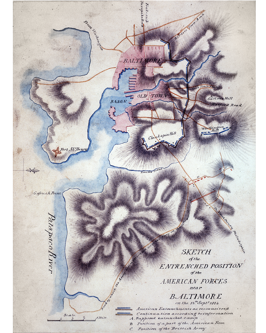
When James Kearney produced his very large manuscript map of the terrain in and around Baltimore in 1817, he used Varle's map as the basis for how he depicted the outline of Baltimore's streets and defenses during the battle of Baltimore. Note that Kearney's depiction of the fortifications running from the Sugar House to the west of Harris's creek when placed on Google Earth come close to their actual locations as they exist today including the fortifications that were near what is today the Pagoda in Patterson Park.
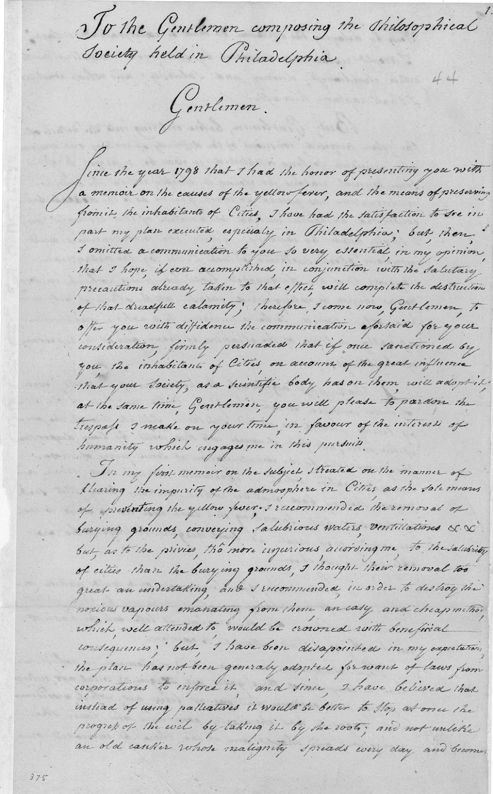
In 1814 Varlé had removed to Frederick, probably because of his concern that Baltimore was not a healthy place to live. There he prepared maps of western Maryland and western Virginia in an effort to promote development in the healthy mountain air of the region. In February of 1814 he hoped for membership in the American Philosophical Society and submitted his recommendations to its President, Thomas Jefferson, for making Baltimore a healthier city by using an innovative approach to cleaning out the city's privies (there would be no sewers in the city until after the great fire of 1904). Neither the Society nor the City proved to be interested in his suggestions at the time, although they would be taken up with a concerted effort on the part of the city fathers during the cholera scares of the 1830s (probably one of the motivating factors for Varlé's retirement to his native Languedoc).
As early as 1811, the city fathers found Varle's map wanting, particularly as it related to the future development of the city. They needed an accurate map on which to extend the streets and monitor development block by block (not the least of which for taxing purposes). Over the next 11 years they negotiated with Thomas Poppleton to produce his map of the city (first printed in 1822) and it became the governing map that made Baltimore and governed its spread outward. In 1814, however, Varlé's map was all that the British had to go by as they attempted to attack the city from the east of Hamstead Hill producing their own reconnaissance of the city's fortifications that was nowhere near as accurate as Varlé's.
No comments:
Post a Comment